Snow to lower levels
3rd February 2026
Only a few pictures today as the visibility was poor again.
It was much colder than yesterday, although with slightly less wind and not as wet it didn’t feel as uncomfortable.
Snow fell down to around 350 metres and seemed to be heaviest overnight which led to access problems on some of the higher roads. Thankfully Glenshee ski area were able to get everything up and running without any delay and many people were enjoying the snow sports on offer.
The recent deposits of windslab below around 900 metres have been slowly consolidating. Above this elevation weaknesses persist in the snowpack due to the colder temperatures and constant drifting. (see report for more detail.)
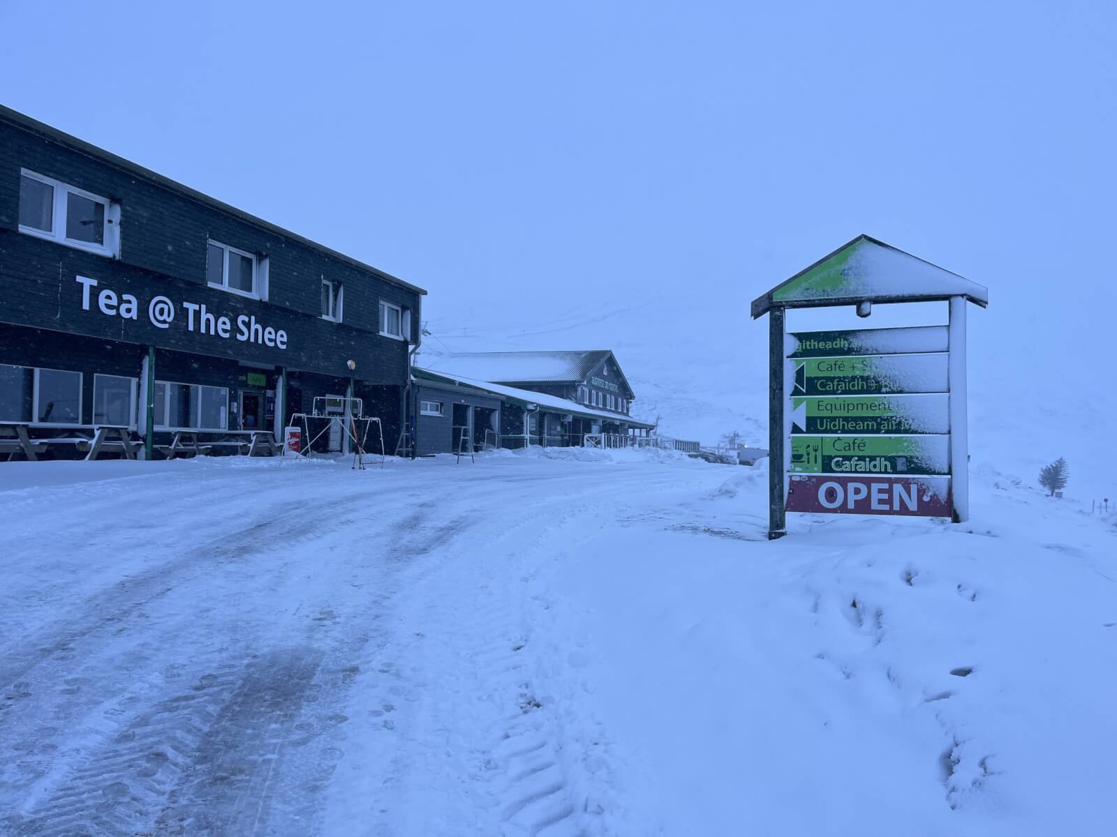
(Above) Open for business. The snow on the green sign hints at a strong wind and snow overnight.
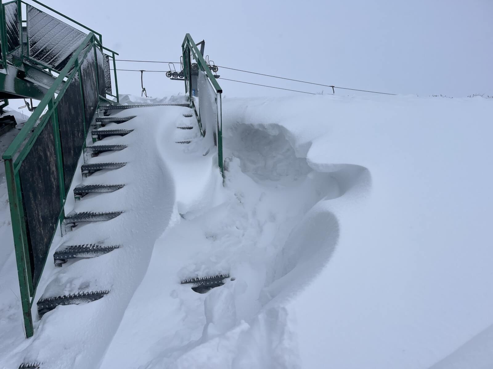
(Above) Drifting within the ski area.
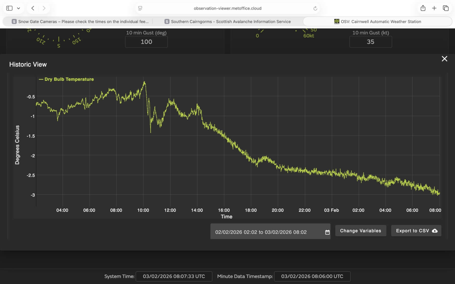
(Above) The graph shows the temperature at 933 metres dropping quickly yesterday afternoon then more gradually overnight.
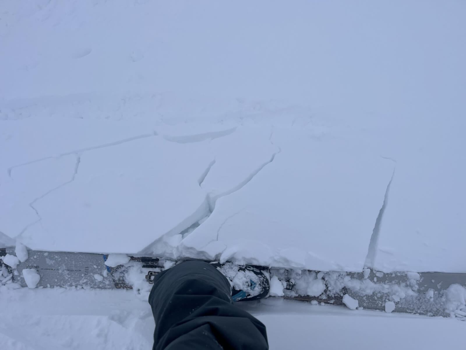
(Above) Unstable snow at around 850 metres on a westerly aspect.
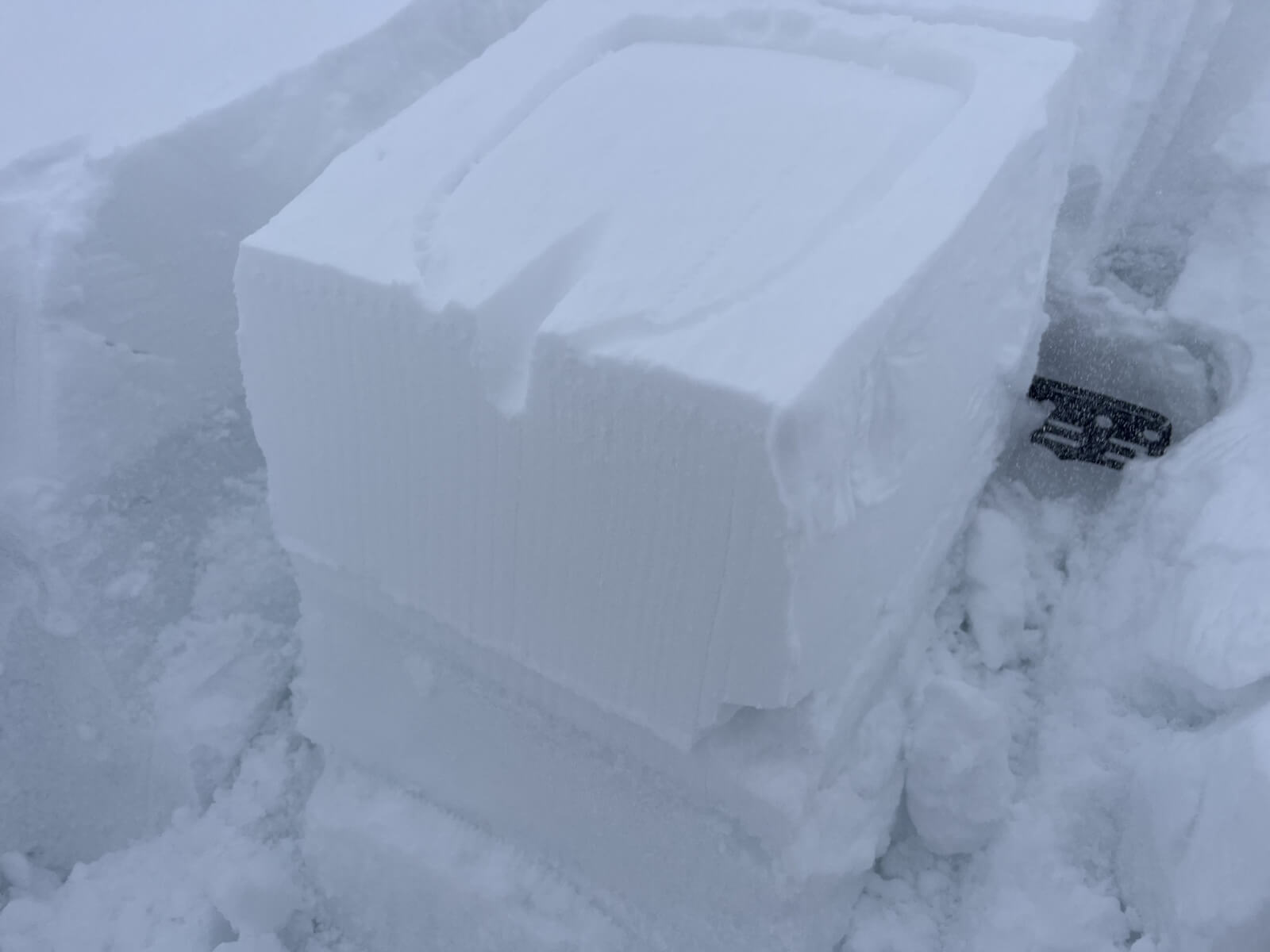
(Above) Shovel compression test revealing some weaknesses in the snowpack at around 900 metres.
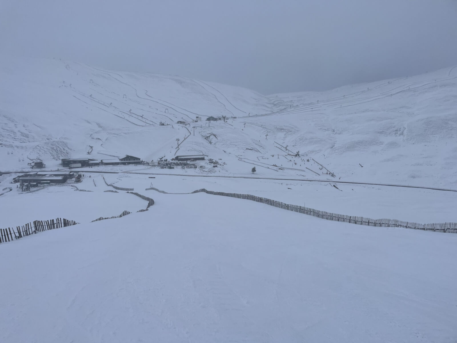
(Above) Glenshee Ski area.
Comments on this post
Got something to say? Leave a comment