Sunny Spells
30th December 2024
Overnight rain quickly eased to bring some light showers today. In the afternoon, there were even some sunny spells especially on the south facing flanks of the Cairngorms.
However, the passage of a complicated frontal system overnight will result in significant precipitation, firstly as snow above 700 metres and then rain at all levels. This creates a complicated forecast where we are likely to see some isolated windslab development at the highest elevations overnight, followed by a some wet snow instability as snow accumulations become saturated. By morning, there will have been extensive snow loss as the freezing level settles well above the summits again.
Correspondingly, river and burn lines are likely to be full during this period of snow melt. Water hazards are likely to be an additional issue for hill goers tomorrow.
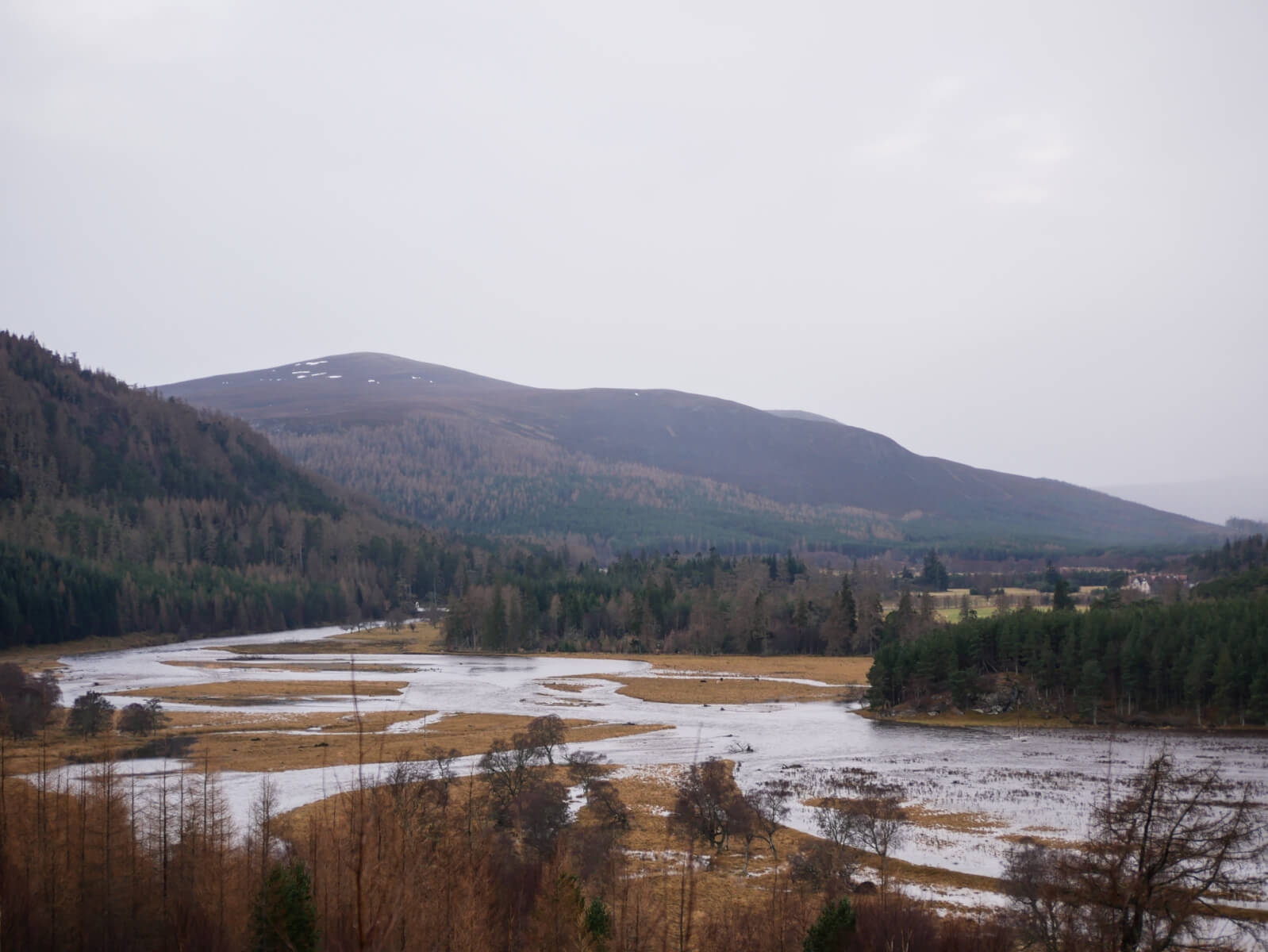
A very full River Dee, looking west towards Mar Lodge. Carn Liath is the main summit centre left.
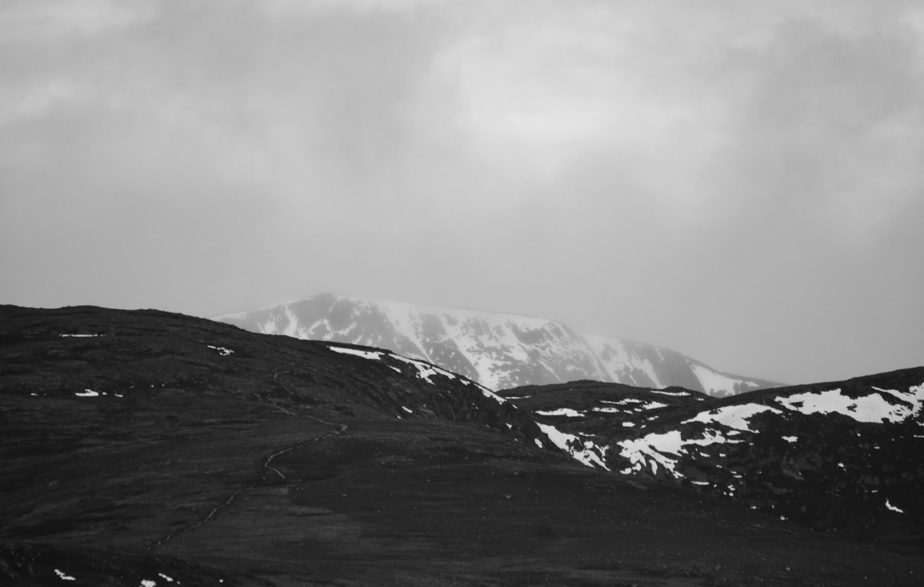
Looking into Coire Sputan Dearg. Still holding a fair bit of snow on the northern boundary of the Southern Cairngorms area.
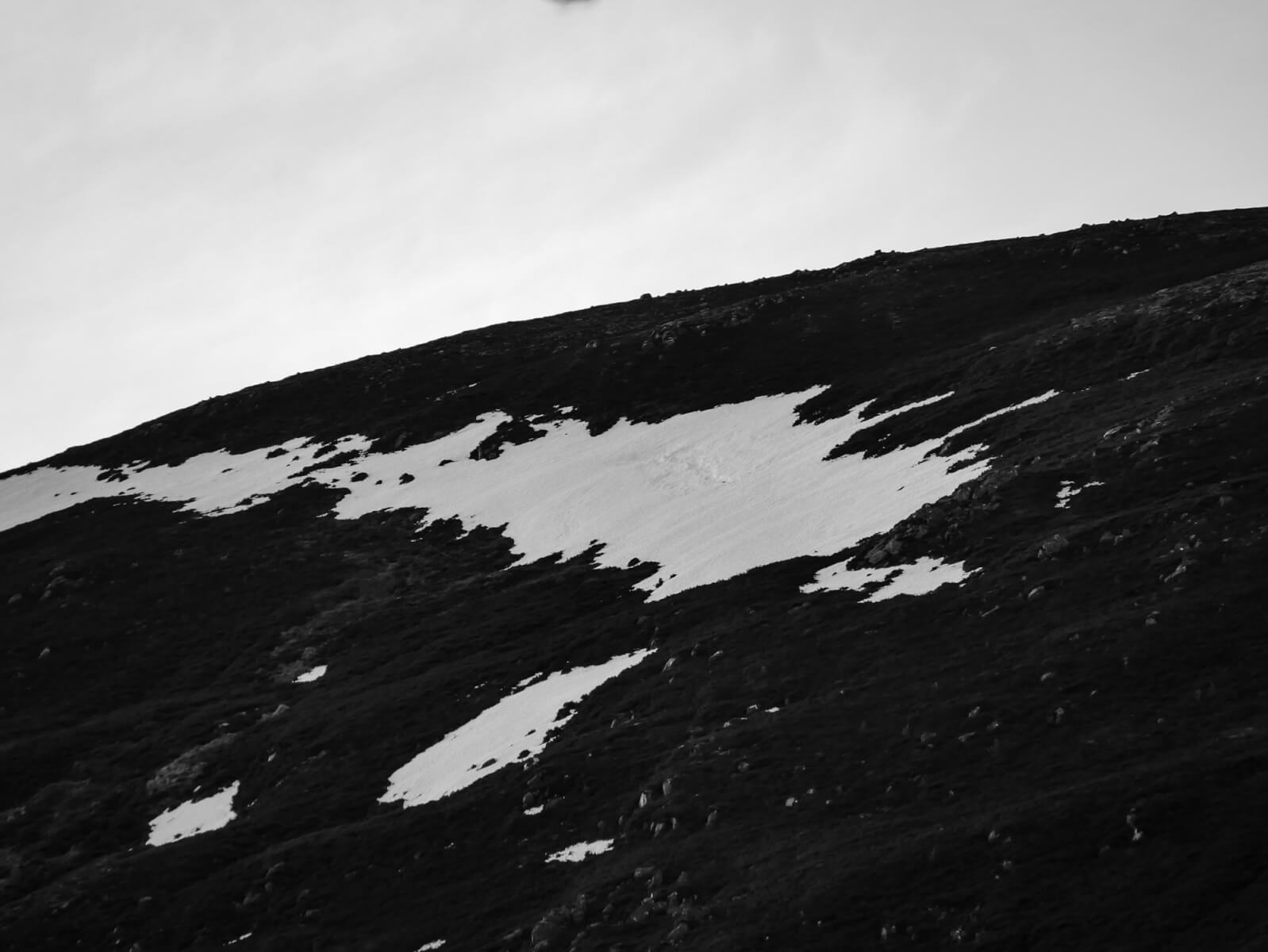
The steep Easterly facing slopes of Sgor Dubh above Derry Lodge. This isolated snow patch is around 700 metres AMSL. Shot with a long lens you may be able to make out the tell tale signs of an old glide crack in the centre of the shot.
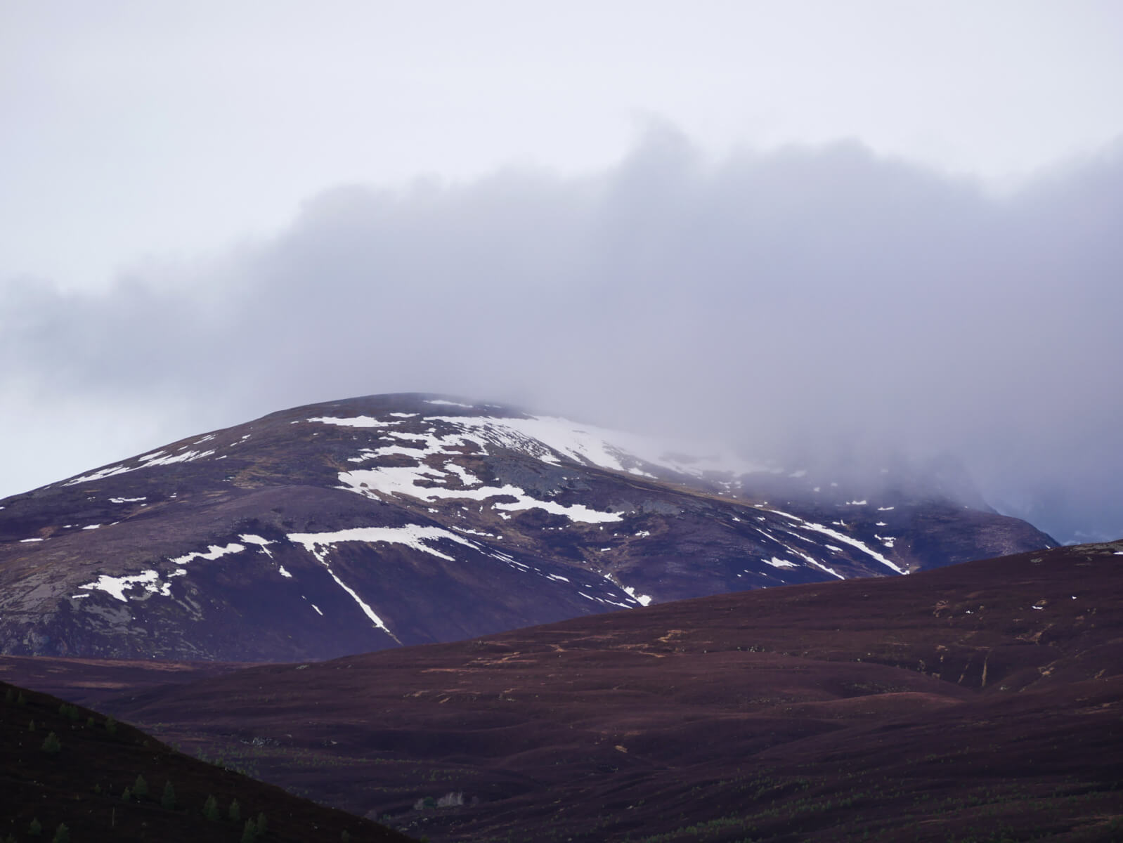
The South-Eastern flank of Benin a’Bhuird. Note the snow patches hanging on despite the high temperatures of late. A couple of vertical ribbons are visible bringing some definition to the the streamlines on this distant mountain side. The furtherest right marks the upper section of Allt an t-Sneachda – one of the most snow sure locations in the Southern Cairngorms (and hence its name).
Comments on this post
Got something to say? Leave a comment


