Lochnagar
5th March 2023
A day of poor visibility on Lochnagar today. There was evidence of a light dusting of snow down to 700 metres and the odd shower continued during the day.
A cold Arctic Maritime airflow is expected to continue for the coming days driving snow showers in off the coast. The north east of the Southern Cairngorms area is likely to receive the greatest frequency of the snow showers. Amounts further into the Cairngorm massif are likely to vary. Snow is likely to drift in the strong winds and cold temperatures. As such unstable windslab is anticipated to build progressively through the forecast period on East, South-East and South aspects above 900 metres. The avalanche hazard will be Moderate.
It looks like it will be cold for some days to come…

A light dusting of snow was visible from around 700 metres. The snow line had obviously been much lower overnight, with the presence of wet snowflakes clinging on behind the odd boulder at lower elevations.
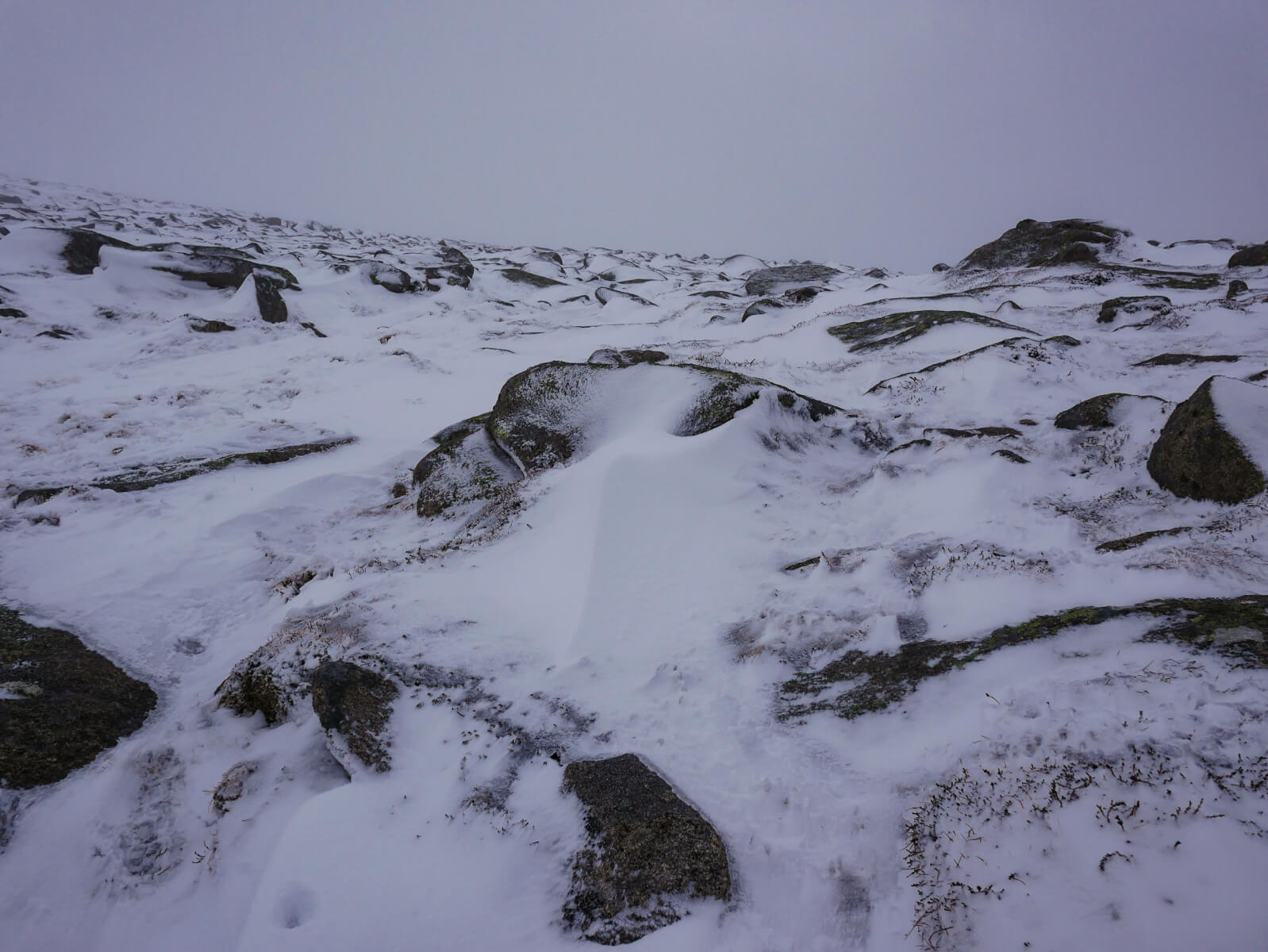
The tell tale wisps of snow transportation behind boulders at around 950 metres on a South-East aspect. Very limited at the moment, but there will be a progressive increase in snow transport tomorrow in the stronger winds, combined with further snowfall.

The only view of Lochnagar today. Not much to see, but the voices in the mist suggested that a few folk were out enjoying their day.
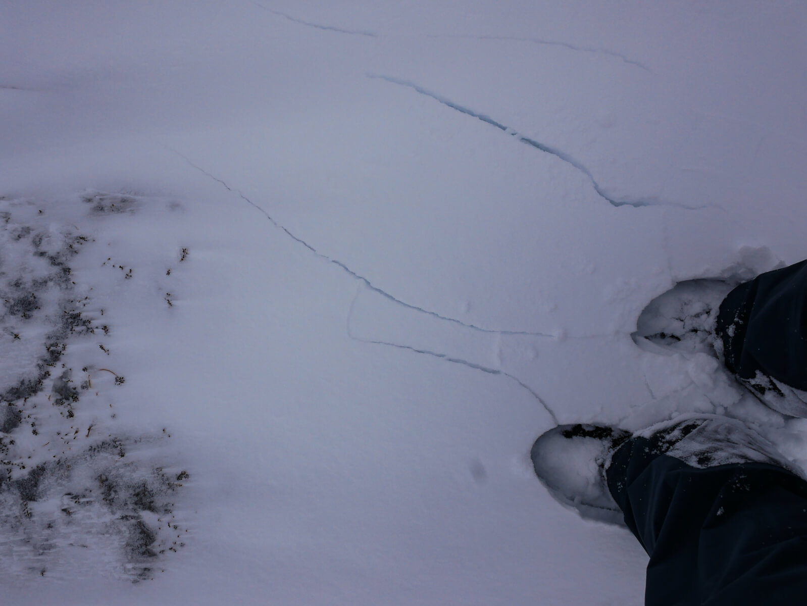
Isolated windslab deposits were noticeable on South and South-East aspects, often in sheltered hollows above 900 metres. The deeper deposits were quite weak and readily demonstrated shooting cracks, especially where the gradient was steeper. Windslab deposited tomorrow will be unstable due to the cold temperatures.
Comments on this post
Got something to say? Leave a comment


