Interesting Weather Approaching…
21st January 2009
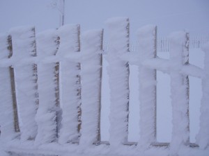
Rime forms on the windward side of an object so it lets you know which direction the local winds have been coming from. And knowing that, you will be able to work out which slopes will have received wind blown deposits. However all this beautiful rime is going to fall off overnight as our official forecast has the freezing level rising to 2500 metres. This will be accompanied by rain and you’ve guessed it – strong winds! This combination of weather will definitely produce avalanche activity overnight. Thankfully it is due to get colder again tomorrow with the freezing level lowering to 900 metres which will help consolidate recent accumulations. We have been forecast some snow showers that will form fresh windslab in the locations mentioned in the main report.
Sam
Comments on this post
Got something to say? Leave a comment


